Tuesday, January 26, 2016

Snakes in Chile ?!?!

Snakes in Chile?
Some city slickers believe there are no snakes in Chile!
Well, guess what?
There are.
Go to this link
https://patagonianaturejournal.wordpress.com/

and find out the real truth about snakes in Chile ....


File:Red milk snake.JPG
Photo borrowed from Wikipedia

Monday, January 25, 2016

Volcan Casablanca

In the Parque Nacional Puyehue are hot springs, a ski resort, and great trails for hiking. You enter this area through the town of Entrelagos. A very nice little town that welcomes Argentinian visitors through the mountain pass.


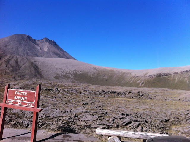
Heading east on Hwy 215 there are great views of the lake and Volcan Puyehue which erupted about 6 years ago. Here also is Termas de Puyehue, a fancy overpriced resort. You can find them on Trip Advisor with mixed reviews. But behind them is Aguas Calientes. I've done a post on this more affordable option to enjoy the hot springs before. If you continue on the road into the park, you can drive the 18 km on a dirt road up to Antillanca, the ski resort. We were up there in the summer so I'll leave a post about the ski resort for another time. In the off season though, for only 10,000 pesos (about $15) you can drive to the top of Volcan Casablanca and it's crater.

Here is part of the ski lodge and at the right is a gate and a sign that says "Al Crater" 10,000 pesos
To the crater, 10,000 pesos per car


A panorama of the crater


The road looking back towards the ski lodge


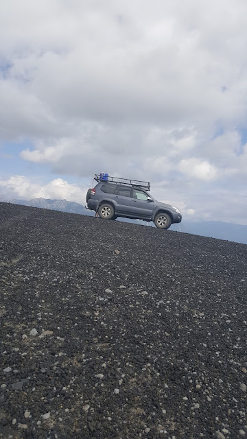
Our Toyota Prada  does great off road


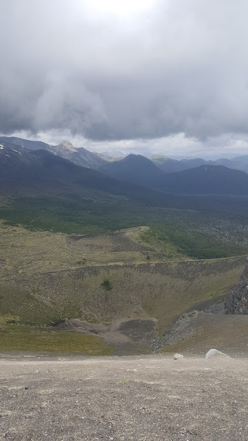
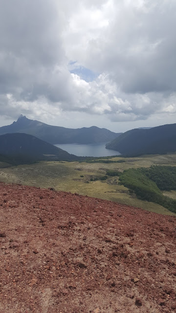
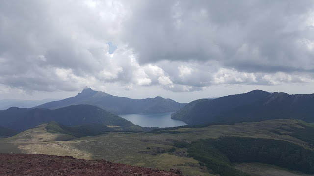
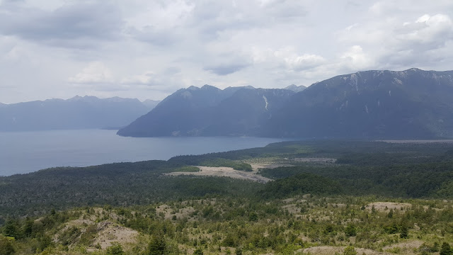
The boys being adventurous and energetic as they are hiked out to that point to the left of Andrew in the above photo. And the rest of these pictures were taken from that view point.


This is looking south towards Volcan Puntiagudo and Lago Rupanco


This is such an awesome place! You feel like you are at the top of the world. And the funny thing is no one is ever here! I have never seen it mentioned in any guide books as a tourist attraction. We just found it by chance and the first time we weren't even sure if we were allowed up there as the gate was open and we just drove in.


Sunday, January 24, 2016

Sendero Desolacion


Desolation Path
Sounds pretty intimidating
24 km of rocky trail up to 5600 ft on the side of a volcano
and down to the lake along the beach
to add to the fun - inches of ash from the last eruption (Calbuco in April 2015)
horse flies from Jurassic Park (fortunately they only live for 3 weeks in January) and the blistering sun which is particularly intense here as the ozone layer is a bit thin.

The journey starts at the Refugio in La Picada which is on the north side of the Volcano Osorno in the Parque Vicentes Perez Rosales There is free parking here and sometimes a little cafe is open.


Here is the start of the trail - not for the faint of heart


The first 4 km is all uphill and very rocky - impassable by car though I think it once was. Jimmy told me they carried their bikes up to the top of the trail at 5600 ft. The sign says high difficulty and walking it would be 10 hours down to the lake and back.


Typical terrain on the way up


At the top!


Worth the work to get up here! A fabulous view of Lago Todos Los Santos and east to Argentina


  You can see Samuel & Andrew on their bikes on the bottom center right


On the right you can see the river heading out of the lake to the sea and there at the head of the river is the small town of Petrohue which is the end of the Sendero.


They made it to Petrohue in 3 hours sunburned and fly bitten but happy for the challenge they conquered. Not much in Pertrohue but a beautiful lodge, a museum, post office, and an office for the ferry and boat tours. More on that in another post!

Saturday, January 16, 2016

Penguins on Chiloe


Last weekend we took the ferry out to Chiloe (pronounce chill-o-way) to see the penguins. We took Ruta 5 (the PanAmerican hwy)south to the end in Pargua to catch the ferry over to the island of Chiloe.


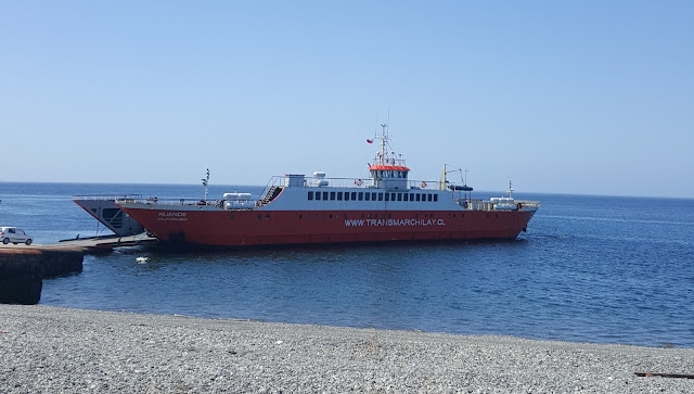
You just drive right on, pay the toll of 12,000 pesos which is about $17 US and enjoy the 30 minute ride over. You can go up top for better viewing. We saw lots of seals swimming in the waves. This is currently the only way to get to the island so there are usually lots of buses and trucks. Sadly, the government is putting in pylons across the Chacao Channel for a bridge. I hope that it doesn't ruin the mystique of this beautiful island.
You then drive to the city of Ancud about 30 minutes away on the north end of the island. It's a pretty fishing town on the bay.
       Once you get into Ancud just follow the signs for about 28 km to the Pinguinera. The views  along the way are spectacular.


At the end of the road, you just drive on the beach and pick your tour boat. There are 4 or 5 services plus a restaurant or 2 and a couple of gift shops.


Tickets are 6,000 pesos for adults and 3,000 for kids for a 30 minute boat ride.
You climb up the cart and they roll you out to the boat tethered in the surf.


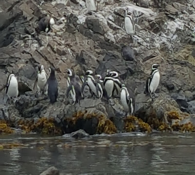
These are either Humboldt or Magellanic penguins. Both live in these waters.

And here are the babies waiting to be fed


We also spotted a kelp goose, some steamer ducks, seals, and kelp gulls. The gulls were catching urchins, dropping them on the rocks to crack them, and gobbling up the yummy slime inside.

On the way home we stopped at our favorite beach for biking and fishing. It is miles and miles of beach with few houses or people. You can access the beach by car just a few kilometers from the Pinguinera. It also has some interesting rock formations and caves.


Coming down the road to our favorite beach


This cool rock has a cave in it


Looking to the south - this cliff face has another cave in it


Miles and miles of empty beach
It's so much fun to drive on!
Another magical, mystical day on Chiloe

Saturday, January 9, 2016

Saltos de Petrohue


 Our oldest son is visiting for the month so we have been giving him the grand chilean tour of the Lakes region. We went to the Saltos de Petrohue which is the rapids on the Petrohue river which runs out of lake Todos Los Santos to the ocean at the bay of Reloncavi. You can access this area at the southeastern end of Lago Lllanquihue at the town of Ensenada taking the partially paved road to Petrohue, a small village on the shore of Lake Todos Los Santos. This area is part of the Parque Vicente Perez-Rosales which is a 977 sq. mile national park which includes the lake and 3 volcanoes.
The entrance to the very nice visitors center which includes a snack bar with outdoor eating area, several gift shops, and free bathrooms. When we went the admission was free but it is not normally. Last April. Volcan Calbuco erupted dumping ash over this area and damaging some of the paths and lookouts so there was some construction being done.

Inside the visitors center

The main falls are not very high but the amount of watering rushing through this basaltic lava chute is impressive.

This bridge was closed during our visit for repairs

The green-blue crystal clear water is spectacular

Trails and bridges make for easy walking throughout the park with views of the river and falls

The end of the trail with a nice view of the river and places to sit on the rocks but no swimming here as the water is moving dangerously fast over the rocks. There is white water rafting on this river but a guide is recommended as they know the best access locations which are not publicly marked and some areas are just too dangerous


Wednesday, January 6, 2016

Las Cascadas

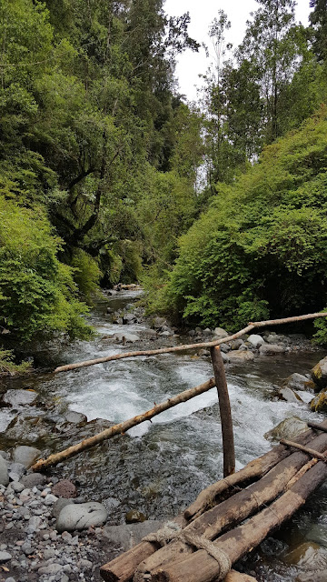
Las Cascadas (or the waterfalls) is a small town on the eastern shore of Lago Llanquihue named for the beautiful waterfall that comes spilling over the side of Volcan Osorno. When you drive into town you take the only road going east and drive 3 km back into the forest on a dirt road to this small privately owned park. Entrance fee is voluntary. There is a bathroom which is 200 pesos to use and sometimes a small snack bar is open during the tourist season. The hike up to the waterfall is an easy 30 minute walk. The only harrowing part of the walk is the little log and wood bridges which cross over the river but these have been recently updated and are a little safer.

All the bridges are the homemade variety
Not handicap accesible!

The river runs through a gorge with steep sides covered in bamboo and nalca which is the big leaves you can see here

Some of the path skirts the river which in the winter can be high so you may have to wade through the water

A log bridge  which is one of the strudier bridges


The waterfall must be about 100+ feet


Here is Andrew walking behind the waterfall
He got quite wet and cold
It was a warm day in the 70's but in the gorge next to the waterfall it was very cool and started to rain on and off from all the water in the air and the rumble of the water falling is quite loud
Very impressive!